|
|
|
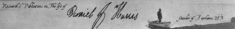
Meet The Author Meet Dan Harris Meet Dan's Family Access Booklets Hear Audio Clips Use Related Links |
The Platting of Fairhaven
The fact that Dan Harris filed his plat for the Town of Fairhaven at 9 A.M. on January 2, 18833 may indicate that he felt a sense of urgency about doing so. It also indicates that the supporting survey was made previously, perhaps in the latter days of 1882. The plat map is entitled "Map of Fairhaven on Harris Bay." All of the accompanying text appears to be in the same handwriting, including the signatures of Dan Harris and Charles Donovan, Whatcom County Auditor and Recorder. While the identity of the surveyor is not disclosed, the fact that the handwriting above the map does not appear to be Dan's and the stylized printing of the caption and the explanation appear to reflect the benefit of more than Dan's eight to ten years of education. To see a copy of Dan's Fairhaven Plat Map and the recording document that accompanied it click
[Map].
The handwritten entry across the top of the plat map contains four errors. It identifies the fractional lot in Section 12 as Lot 1 instead of Lot 3 and gives the initial point as 40 feet south of the northwest corner of Lot 1 in Section 1 instead of the southwest corner. The entry states that the initial point is the northwest corner of Block 1 instead of the center line of Douglas Avenue. Consequently, the entire eighty-foot width of Douglas Avenue is shown as being included in the plat when only half of it should have been included. The plat of the adjacent Town of Bellingham filed on April 24, 1883, less than four months after the plat of Fairhaven, correctly includes only the northern half of Douglas Avenue. The Amended Plat of Fairhaven filed by J. J. Donovan on May 11, 1889, correctly includes only the southern half of Douglas Avenue. The plat map shows a grid of ninety-three blocks laid out around the shore of Harris Bay in the shape of a reversed "L". This total includes three tiers of unnumbered blocks lying south of McKenzie Avenue along unlabeled streets that were later called Larrabee and Donovan. If numbered, these blocks would have been 49 through 85. The plat map also shows three full blocks and three partial blocks below the bluff on the east side of Harris Bay platted in the tidelands, as well as two partial blocks on the south side of Harris Bay and two full and two partial blocks on the west side of Deadman's Point. Six blocks at the mouth of Padden Creek were reserved for a saw mill. If numbered, these would have been Blocks 27, 28, 29, 40, 41 and 42. Two blocks further west, between 3rd and 4th Streets, were reserved for a ship yard. If numbered, these would have been Blocks 24 and 45. The plat map allocated no space for alleys and reserved no land for public uses such as schools, municipal buildings or parks. All of the blocks were 200 feet square and divided into eight lots each, measuring 50' x 100'. To maximize views of the water, the thirty numbered blocks on the east side of Harris Bay were divided by lines running north and south, so the resulting lots faced east and west. Likewise, the seven numbered blocks and three unnumbered blocks on the south side of Harris Bay were divided by lines running east and west, so the resulting lots faced north and south. The numbering of blocks began at the intersection of 9th Street and Douglas Avenue in the northwest corner of the plat and proceeded from west to east and east to west in a serpentine pattern ending with Block 47 at the west end of McKenzie Avenue with an additional block in the tideland being unnumbered. Thirty-seven blocks were numbered and three were not. The plat map shows thirty-seven blocks south of McKenzie Avenue that were not divided into lots. The plat map also shows what appear to be northern and eastern boundary lines and none for the south and west sides. Since the position of the eastern boundary of the plat map had to coincide with the eastern boundary of Dan's DLC, it actually split the nine easternmost blocks in half from north to south. This was indicated by crosshatchings being placed on the eastern half of each of six numbered blocks on the east side of 13th Street. The three unnumbered blocks at the south end of the eastern boundary would also have been split in the same manner although this is not shown on the plat map. The plat map showed nine named streets running east and west. Starting from the north these were: Douglas, Gambier, Knox, Columbia, Mill, Harris and McKenzie. All of these were called "Streets" except for Douglas and McKenzie, which were labeled as "Avenues." The plat map showed thirteen numbered streets running north and south starting at Deadman's Point, with 1st Street being in the tidelands. The plat map made no reference to the corner of Sections 1, 2, 11 and 12, which is just over forty feet south of the center of the intersection of Seventh Street and the present-day Donovan Avenue. The five blocks lying West of 7th Street between McKenzie Avenue and the present-day Larrabee Avenue are actually located in Section 11 on land that was part of the original claim of Alonzo M. Poe and had not been included in Dan Harris' purchase of the Deadman's Point area. Omitting these illegal blocks, the plat map would show that the total land available for Dan Harris to sell was comprised of 296 lots, twenty-eight full blocks and four half blocks not divided into lots, plus the two areas reserved for commercial uses to sell. Also available for sale were 75 acres south and east of the platted portion of his claim. Although Dan Harris did not close the sale of his first lot until February 6, 1883, the news about the establishment Fairhaven quickly spread around the State of Washington as indicated by the following brief announcement that appeared in The Washington Standard on January 26th: A New town has been laid out near Whatcom and named Fairhaven. It is on a deep-water bay, a mile south of Sehome, and on the line of the contemplated railroad line from Seattle to Burrard Inlet.3 |