|
|
|
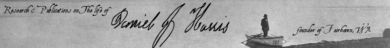
Meet The Author Meet Dan Harris Meet Dan's Family Access Booklets Hear Audio Clips Use Related Links |
ENDNOTES Comments A. According to the DLCA, married settlers arriving in Oregon Territory prior to December 1, 1850 were entitled to one section of land, or 640 acres, and single settlers to half a section. Settlers arriving between December 1, 1850 and December 1, 1853 (later extended to December 1, 1855) were entitled to half as much. Claims settled before completion of the rectangular survey mandated by the DLCA were required to be laid out by metes and bounds in a compact form with the lines running east and west, and north and south. Claims settled after completion of the survey were directed to be made in conformity with it the claimant was required to notify the Territorial Surveyor General of the precise tract claimed within three months of settlement or within three months of the completion of the rectangular survey, which ever came first. (This stipulation seems not to have been rigidly enforced, as will be noted.) Within twelve months of settlement or completion of the survey, which ever came first, the claimant was required to submit proof of settlement and cultivation. The claimant was further required, at any time after four years of settlement, to give proof supported by two disinterested witnesses, of continued residence and cultivation for at least that period of time Finally, a claimant was required to submit an affidavit that the land being claimed was for personal use and cultivation and that the claimant was not acting on behalf of a third party and had made no agreement to sell or transfer the land. Thereupon, a certificate was issued giving marketable title to the claim and a patent was obtainable upon surrender of the certificate. The provisions of the DLCA continued in force for settlers of Washington Territory after it was created out of Oregon Territory on March 2, 1853. Washington Territory achieved statehood on November 11, 1889. [Return] B. Ellis and John Barnes, Enoch C. Compton, Edward Eldridge, Edward C. Fitzhugh, Daniel J. Harris, James G. Hedge, Thomas Jones, John W. Lysle, James Morrison, Morris O'Connor, Harry C. Page, William R. Pattle, Russel V. Peabody, Alonzo M. Poe, Charles E. Roberts, Henry Roeder, William Utter and Charles C. Vail. Only seventeen patents were issued since the Barnes brothers' claims lay on the land of the Lummi Reservation. [Return] C. Island County originally included the area now occupied by San Juan, Skagit, Snohomish and Whatcom Counties. Whatcom County was formed out of Island County on March 6, 1854. [Return] D. William R. Pattle, James Morrison, John Thomas on April 18, 1853,Edward C. Fitzhugh on August 15, 1853, Harry C. Page, William Utter and Charles C. Vail on December 13, 1853, Russel V. Peabody on January 15, 1854, Morris O'Connor on February 9, 1854, Edward Eldridge on February 28, 1854, & Henry Roeder on March 1, 1854. [Return] E. Washington Territory became a separate surveying district as of January 1, 1855 under a July 17, 1854 amendment to the Donation Land Claim Act of 1850. [Return] F. The preprinted form used for this statement contains the phrase "that he was a resident thereof (Whatcom County) between the twenty-seventh day of September, and the first day of December, 1850." Being untrue, this statement should have been crossed out. [Return] G. James Morrison's DLC File indicates that he had taken refuge in the fort at Whatcom during the Indian War of 1855-56. Perhaps, Dan Harris did so as well. [Return] H. Since no newspapers were being published in Whatcom County during mid-1858, Dan Harris's "Final Notice" was probably submitted to the County Auditor for posting as a public announcement. Regrettably, no copy of such an item has been discovered. [Return] I. Those of Enoch Compton, Edward Eldridge, Edward C. Fitzhugh, Daniel. J. Harris, James G. Hedge, Thomas Jones, John W. Lysle, James Morrison, Morris O'Connor, Harry C. Page, William R. Pattle, Russel V. Peabody, Charles E. Roberts, Henry Roeder, William Utter and Charles C. Vail. Apparently, the claims of John and Ellis Barnes, Charles E. Roberts and Alonzo M. Poe were surveyed previously. [Return] J. Why the line did not run directly to the corner and avoid this jog is not clear.[Return] K. The field notes say that the eastern boundary crossed the line between Sections 1 and 12 at a point that was 5.04 chains (332.64 feet) north of the southeast corner of the claim while the southwest corner was 5.00 chains (330 feet) of the line between Sections 2 and 11 and the southern boundary of the claim crossed the line between Sections 11 and 12 was 4.95 chains (326.7 feet) south of the intersection of Sections 1, 1, 11 and 12. If these three measurements were accurate, the southern boundary line of the claim would have been slightly convex rather than straight.[Return] L. The field notes of the 1861 survey for the Harris claim contain a serious flaw. They locate the northeast corner of the claim 27.32 chains (1,803.12 feet) east if the line between Sections 1 and 2 (8.74 chains for the distance from the section line to the northwest corner plus 18.58 chains for the distance between the northwest and northeast corners). The field notes give the total distance between claim's southwest and southeast corners as 58.00 chains (3,828.00 feet), which seems correct, however they give the distance from the southwest corner to the line between Sections 11 and 12 (the extension of the line between Sections 1 and 2) as 38.18 chains (2,519.88 feet), leaving only 19.82 chains (1,308.12 feet) for the distance from that line to the south-east corner. The survey notes for the O'Connor claim place its northwest corner, which is the same point as the northeast corner of the Harris claim, 27.17 chains (1,793.22 feet) east of the line between Sections 1 and 2. This is a 9.9 feet less than the distance given in the field notes for the Harris claim. The field notes also contain a minor flaw, giving the bearing from the northeast corner as being, "East along the North boundary of the claim" rather than west. [Return] M. The beginning reference point in this affidavit is 29.7 feet further north and 11.22 feet further east than the same point in the official survey finished four months earlier, which Dan Harris had likely not seen. The statement "running thence one half mile east along the eastern side of Bellingham Bay" should read "one half mile south and west." [Return] N. Six successive issues of The Pioneer And Democrat had carried a notice by Isaac W. Smith, Registrar and J. S. M. Van Cleave, Receiver, advising settlers of Donation Claims in forty-eight townships of Washington Territory, including Township 37 North, Range 2 East, that they were required to file a connection of their claims to the Government Survey by March 4, 1861 or risk the forfeiture of their claim under the Act of July 17, 1854.50 [Return] O. Except for the patents issued to Poe and Harris, all the other patents for DLC's around Bellingham Bay were described by linear measurements and compass bearings, although many contained fractional lots. [Return] P. The beginning reference point of the O'Connor claim should have been the southeast corner of Section 1 rather than the northeast corner. The claim was virtually 40 chains square, lying mostly in Section 1 with a strip about 320 feet wide along its southern edge lying in Section 12. [Return] Q. The respective sizes of the six parcels in Dan Harris's DLC were 12.6 acres, 35.0 acres, 10.8 acres, 14.44 acres, 40.0 acres and 33.56 acres, for a total of 146.4 acres. [Return] |